In his 1823 book, A Narrative of a Tour through Hawaii, British missionary and writer William Ellis described Keaʻau thusly:
“Soon after five p.m. we reached Kaau (sic), the last village in the division of Puna. It was extensive and populous, abounding with well-cultivated plantations of taro, sweet potatoes, and sugarcane; and probably owes its fertility to a fine rapid stream of water, which, descending from the mountains, runs through, it into the sea. It was the second stream we had seen on the island.”
The “fine, rapid stream of water” Ellis describes likely referred to the outflow of Keaʻauloa, the large fishpond at Hāʻena in the ahupuaʻa of Keaʻau, rather than a stream.
In a 1982 report on Kahaualeʻa, Puna, Hawaiʻi by waterman and Polynesian Voyaging Society co-founder Tommy Holmes, he cited E.S.C. Handy, who wrote that “one of the most interesting things about Puna is that Hawaiians believe, and their traditions imply, that this was once Hawaii’s richest agricultural region and that it is only in relatively recent time that volcanic eruption has destroyed much of its best land.”
Geologist Clarence Edward Dutton recorded in his travels through Puna in the early 1880s that, “the traditions of the natives declare that no King ever reigned in Puna without seeing large parts of his dominion overflowed.”
While probably an exaggeration, the statement nevertheless illustrates the fact that the Puna’s allegedly fertile lands were as much threatened and scourged in pre- as in post-contact times.
According to available scientific data, for the past 2,500 years Kīlauea has alternated between explosive and lava-flow-dominated activity. A prolonged, 1,200-year-long episode of explosiveness ended around 1000; the next began in 1500 and lasted about 300 years.
Puna, with an abundance of rain, is able to clothe relatively fresh lava flows with vegetation very quickly. Residential lots on Kualoloa flows, bulldozed for building, have excellent, though alien, vegetative cover growing out of bare rock a year later.
Lava flows between 1410 and 1470 destroyed Hiʻiaka’s beloved ʻōhia forests and buried Puna from what is now Kīlauea Iki to the coast, from Hāʻena to Hawaiian Beaches. The largest remaining kīpuka is Wao Kele o Puna, stewarded by the Office of Hawaiian Affairs.
Starting about 1500, Puna experienced another period of explosiveness that lasted till about 1800. After massive explosions at Kaluapele o Kīlauea in 1790 resulted in many deaths – including warriors from the army of Kaʻū Aliʻi Keōua Kūahuʻula – lava flows returned to Puna ma kai.
Few people understand our geologic history. Even when looking at recent flows while driving around, most don’t realize that the rocky landscape is our gift from Pele. It is important to understand that those of us in Puna live on an active volcano. There can be long periods of stability, when flows don’t threaten homes or livelihood, but there are times when Pele is very active.
Pelehonuamea is the eruptive energy of Hawaiian volcanism. She reveals herself to us in the form of flowing molten lava. Pele has created all of our pae ʻāina, the archipelago that is Hawaiʻi. After Pele does her work of creation her sister, Hiʻiaka, begins to clothe fresh lava with vegetation. The cycles of eruptive growth and plant growth have gone on since time immemorial. Those who understand that fact realize that we and our modern works are only here temporarily.
Puna may have indeed been a very rich agricultural region, if we take 1,500 – 3,000-year-old kīpuka as clues. Older lava + rain = excellent growth. For example, the rain forest on the rim of Kaluapele o Kīlauea is less than 235 years old, its summit having been devastated in 1790.
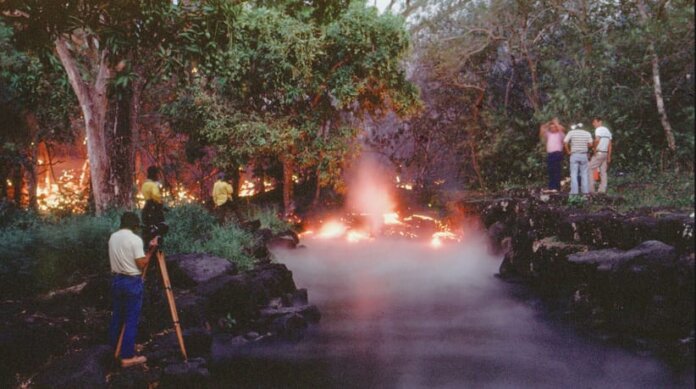
More recently, Kīlauea has been very active. On the lower East Rift Zone, there were eruptions in 1790, 1840, 1955, 1960, 1977, and from 1983 to 2018 – the latter, from three separate vents: Puʻuʻōʻō, Kupaianaha, and Fissure 8 mā buried all but our memories.
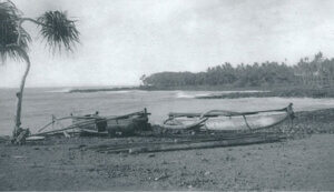
Gone are the Kamoamoa beach of black sand, Kamoamoa campground, Wahaʻula Heiau and Visitor Center, Punaluʻu (Queen’s Bath) pond and heiau, Waiʻākōlea ponds, Harry K. Brown Park and ponds, the canoe landing at Kalapana, “Drainpipe” surf spot, Kaimū beach, Pohoiki Boat Ramp, Ahalanui warm pond, Kapoho tide pools, Kapoho town, Warm Springs at Kapoho, and Higashi Pond at Kumukahi – all are gone, along with hundreds of homes and many businesses. In 1955, one of the flows created the black sands that now form Kehena, one of the last beaches in Puna.
Life is cyclical. We are born, live lives, then die. The ʻāina, the land, on active volcanoes also goes through cyclical processes. It is born during lava flows, clothed with vegetation and soils, ʻāina supports and sustains residents, and eventually, on Kīlauea, it is reburied.
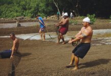
Hawaiians have lived in Puna for a thousand years. They learned about, and understood, their ʻāina and their resources. They lived within their limits and knew their places on the land. Residents fished the waters of their ahupuaʻa using a variety of methods, including pole fishing from shore, nets cast or laid, canoes slid in on sand beaches or on canoe ladders lashed to the tops of low sea cliffs. Shellfish, crabs, and limu were gathered along the shore by residents of adjoining ahupuaʻa.
These days, traditional konohiki management practices have nearly been abandoned. But more importantly, there seems to be a collective amnesia, a forgetting, of our history. Our histories of living with, rather than in opposition to, our circumstances and environment must be acknowledged.
Understanding centuries of change is critical. Especially in these times of instant gratification and speedy communications, we must all remember that the land is the chief and we are its servants, Ke aliʻi ka ʻāina, he kauā ke kānaka. We should not attempt to exert our will on Pele. She must be accommodated, and we are the ones who must adjust to new realities.